
Camp Stone
Updated: 2011-11-13. Something not right? Please update the information.
| Size | 44 ha (109 acres) |
|---|---|
| Coordinates | 49.635142,-116.003228 |
| Street Address | 600 St. Mary Lake Road, Kimberley, BC (Map may be inaccurate) |
| Nearest town | Kimberley, British Columbia |
| NTS Map | 82F/9: St. Mary Lake |
| Operated by | Scouts Canada, Cascadia Council, 1st Kimberley Scout Group |
| Information | Cheryl McIvor; Phone: +1 250 427 7640 |
| Bookings | Same as above |
| Accommodation | Facilities | Program |
|---|---|---|
| Tenting sites: Yes Adirondack shelters: No Villages: No Cabins: No |
Drinking water: Yes Emergency phone: No Mobile phone coverage: Yes Electric vehicle charging: Unknown Picnic tables: Yes Cooking shelters: Yes Appliances in cabins: No On-site store: No Shopping nearby: Yes Showers: No Indoor washrooms: Yes Wheelchair washroom: Yes |
|
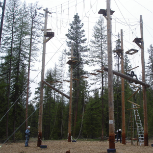
Description
After leasing the land to Scouts Canada for many years, Teck Cominco, a mining company, donated it in June 2001 as their nearby mine was closing. The agreement stipulates that it be used for recreational purposes and not sold for 80 years.
For More Information
| Information | Cheryl McIvor; Phone: +1 250 427 7640 |
|---|---|
| Bookings | Same as above |
Driving Directions
Nearest Other Camps
- OCamp Beattie (88 km)
- CCamp Impeesa (126 km)
- OCamp Tweedsmuir (127 km)
- NBanff Scout-Guide Hall (174 km)
- OCamp Wenman (184 km)
- CCamp Gardner (190 km)
- ORevelstoke Scout Camp (218 km)
- OLost Lake Scout Camp (222 km)
- NCamp Winchell Coulee (225 km)
- OPear Lake Wilderness Cabin (229 km)
This information was gathered from reader contributions: use at your own risk.